Human vs machine as top poker pros take on AI

mg22630202.100-1_1200 (1)

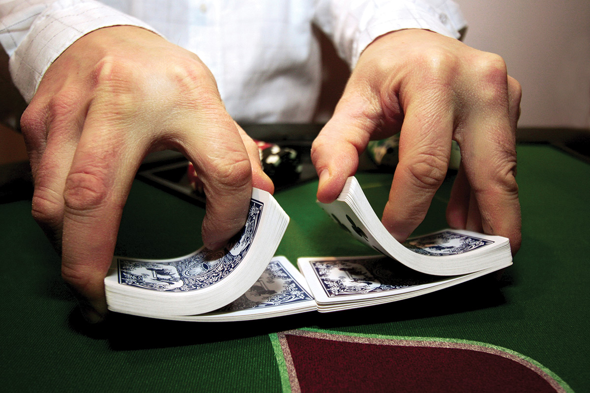
IT’S humans versus machine at the Rivers casino in Pittsburgh, Pennsylvania. Four professional poker players are squaring up to an artificial intelligence over two weeks, duking it out by playing a total of 80,000 hands of poker for a $100,000 cash prize.

This may turn out to be the latest instalment in a grand tradition of computers beating us at our own games. In 1997, IBM’s Deep Blue computer famously beat chess great Garry Kasparov. Four years ago, IBM’s Watson took part in the TV quiz show Jeopardy! and crushed two contestants with a strong track record. AI has even mastered the popular smartphone game 2048.

Still, poker is a tough nut to crack. In a game like chess, everyone knows where all the pieces are on the board. By contrast, poker is a game of imperfect information: players don’t know for sure what cards the others hold or what will come up next in the deck. That makes it a challenge for any player, human or computer, to choose the right play.

Computer scientists have already made some progress, at least with simpler forms of the game. But the version being played at the Pittsburgh tournament, called Heads Up No Limit Texas Hold ’em, is “a completely different beast”, says pro player Vanessa Selbst. “There’s much more human elements and game strategies to employ, so it’s a much more complex game.” What’s more, there are no betting limits, so the computer also has to take into account how much players might stake on each game.

Competing in Pittsburgh is Claudico, a program created at the city’s Carnegie Mellon University. Claudico taught itself poker skills by playing trillions of games in search of some kind of optimal strategy. Whatever it has picked is pretty good: last year, Claudico beat all 13 other computer competitors at no-limit poker in the annual contest run by the Association for the Advancement of Artificial Intelligence.

Computers have a few edges over humans, says graduate student Noam Brown, part of the team behind Claudico. For example, a computer can switch randomly between various betting strategies, which may confuse human opponents.

On the other hand, Claudico is slow to pick up on and adapt to people’s playing styles – something that many pro players do with ease. “One of our big concerns is that the human will be able to identify weaknesses that Claudico has and exploit them,” says Brown.

Because Claudico taught itself to play, even the team that built it don’t quite know how it picks its moves. “We’re putting our faith in Claudico. It knows much better than we do what it’s doing.”

Algorithms like those used to play poker could be valuable for other kinds of problems characterised by imperfect information. They could suggest optimal locations for military resources in a war, for example. Rival AIs could also be tasked to negotiate with each other over insurance rates or handle legal squabbles. “In society, sometimes you see one side getting screwed over because someone has more lawyers or more information or more resources at their disposal,” says Brown. “Something like this can really level the playing field.”

The winner of the poker tournament won’t be crowned until the event ends on 7 May. Eric Jackson, a software engineer who creates poker bots as a hobby, is cautiously optimistic that Claudico can win. As we went to press, the pros and Claudico were neck and neck.

Even if AI triumphs, it won’t mean programmers have conquered the game. “Beating humans decisively would be a landmark, but it wouldn’t mean the end of work on poker,” says Jackson. “We still don’t know what the perfect strategy is.”

References:http://www.newscientist.com/

‘Centimetre accurate’ GPS system could transform virtual reality and mobile devices

35-pizza-delivery-drone-gps

Researchers at the University of Texas at Austin have developed a centimetre-accurate GPS-based positioning system that could revolutionise geolocation on virtual reality headsets, cellphones and other technologies – making global positioning and orientation far more precise than what is currently available on a mobile device.

The researchers’ new system could allow unmanned aerial vehicles to deliver packages to a specific spot on a consumer’s back porch, improve collision avoidance technologies on cars and allow virtual reality (VR) headsets to be used outdoors. This ultra-accurate GPS, coupled with a smartphone camera, could be used to quickly build a globally referenced 3-D map of one’s surroundings that would greatly expand the radius of a VR game. Currently, VR does not use GPS, which limits its use to indoors and usually a two- to three-foot radius.

“Imagine games where, rather than sit in front of a monitor and play, you are in your backyard actually running around with other players,” said Todd Humphreys, lead researcher and assistant professor in the Department of Aerospace Engineering and Engineering Mechanics. “To be able to do this type of outdoor, multiplayer virtual reality game, you need highly accurate position and orientation that is tied to a global reference frame.”

Humphreys and his team in the Radionavigation Lab have designed a low-cost system that reduces location errors from the size of a large car to the size of a nickel – a more than 100 times increase in accuracy. Humphreys collaborated on the new technology with Professor Robert W. Heath from the Department of Electrical and Computer Engineering, along with graduate students.

Centimetre-accurate positioning systems are already used in geology, surveying and mapping – but the survey-grade antennas these systems employ are too large and costly for use in mobile devices. This breakthrough by Humphreys and his team is a powerful and sensitive software-defined GPS receiver that can extract centimetre accuracies from the inexpensive antennas found in mobile devices. Such precise measurements were not previously possible. The researchers anticipate that their software’s ability to leverage low-cost antennas will reduce the overall cost of centimetre accuracy and make it economically feasible for mobile devices.

Humphreys and his team have spent six years building a specialised receiver, called GRID, to extract so-called carrier phase measurements from low-cost antennas. GRID currently operates outside the phone, but it will eventually run on the phone’s internal processor. To further develop this technology, they recently co-founded a startup, called Radiosense. Humphreys and his team are working with Samsung to develop a snap-on accessory that will tell smartphones, tablets and virtual reality headsets their precise position and orientation.

The researchers designed their system to deliver precise position and orientation information – how one’s head rotates or tilts – to less than one degree of measurement accuracy. This level of accuracy could enhance VR environments that are based on real-world settings, as well as improve other applications including visualisation and 3-D mapping. Additionally, it could make a significant difference in people’s daily lives, including transportation, where centimetre-accurate GPS could allow better vehicle-to-vehicle communication technology.

“If your car knows in real time the precise position and velocity of an approaching car that is blocked from view by other traffic, your car can plan ahead to avoid a collision,” Humphreys said.

References :http://www.futuretimeline.net/

How to turn a basic electronics lab into a low-cost, advanced telecommunications one

1-howtoturnaba

A piece of work by the NUP/UPNA-Public University of Navarre on how to turn a basic electronics lab into a low-cost, complete telecommunications lab has received the best paper award in the category of “Innovative Materials, Teaching and Learning Experiences in Engineering Education” at the 6th IEEE Global Education Conference (EDUCON). The conference, held recently in Tallinn (Estonia), is regarded as one of the main events worldwide in the field of engineering education.

The award-winning paper entitled “Turning a basic electronics lab into a low-cost communication systems lab” was presented by its author, Antonio López-Martín. This NUP/UPNA professor has connected the basic instrumentation of an electronics lab to a computer and has written some software which allows the measuring data to be acquired and complex, costly instrumentation equipment for communications to be emulated on the computer. That way it is possible to give experimental classes in telecommunications using economical equipment already existing at most universities without any additional expense or additional learning time having to be devoted to the instrumentation.

As Antonio López-Martín pointed out, “the invention is particularly attractive for universities in developing countries that cannot afford the expensive equipment needed for a degree in Telecommunications Engineering”. The work has made a considerable impact in the international community and the software has already been transferred to universities in the United States and Mexico and to a research centre in Australia.

This author was previously the first European to receive the award for best paper in “IEEE Transactions on Education”, the journal that is a reference worldwide in engineering education.

References:www.phys.org

DARPA seeks a “100x zoom lens” for seeing distant space objects more clearly

darpaseeksa1

Imaging of Earth from satellites in space has vastly improved in recent years. But the opposite challenge—using Earth-based systems to find, track and provide detailed characterization of satellites and other objects in high orbits—has frustrated engineers even as the need for space domain awareness has grown. State-of-the-art imagery of objects in low Earth orbit (LEO), up to 2,000 km (1,200 miles) high, can achieve resolution of 1 pixel for every 10 cm today, providing relatively crisp details. But image resolution for objects in geosynchronous Earth orbit (GEO), a favorite parking place for space assets roughly 36,000 km (22,000 miles) high, drops to just 1 pixel for every 2 meters, meaning many GEO satellites appear as little more than fuzzy blobs when viewed from Earth. Enabling LEO-quality images of objects in GEO would greatly enhance the nation’s ability to keep an eye on the military, civilian and commercial satellites on which society has come to depend, and to coordinate ground-based efforts to make repairs or correct malfunctions when they occur.
Achieving that goal will require radical technological advances because traditional or “monolithic” telescopes designed to provide high-resolution images of objects in GEO would be too physically and financially impractical to construct. For instance, achieving image resolution of 1 pixel to 10 cm for objects at GEO would require the equivalent of a primary imaging mirror 200 meters in diameter—longer than two football fields. To overcome these limitations and expedite the possible development of revolutionary benefits, DARPA has issued a Request for Information (RFI) (go.usa.gov/3Buvx) seeking specific technological information and innovative ideas demonstrating the potential for high-resolution imaging of GEO objects.
The RFI envisions a ground-based system that would be a sparse-aperture interferometer, which instead of relying upon one primary imaging mirror would measure the interference patterns of light detected by multiple smaller telescopes, from which a composite image could be derived. The GEO-imaging interferometer would rely on only passive (solar) illumination or thermal self-emission from imaged objects and could require the use of many telescopes, quite likely in a reconfigurable array. Responses to the RFI may inform a potential future program.
“We’re looking for ideas on how to create ground-based sparse aperture telescope systems that would provide GEO imagery as clear as current LEO imagery,” said Lindsay Millard, DARPA program manager. “This ‘100x zoom lens’ would provide the first ground-based capability to quickly assess anomalies that happen to GEO satellites, such as improperly deployed antennas or partially unfurled solar panels. With that capability, satellite owners could identify and fix problems more effectively and increase their satellites’ operating lifetimes and performance.”
“The image resolution this RFI envisions—down to a milli-arcsecond, or approximately one-3.6-millionth of a degree—would be up to 100 times more powerful than the current state of the art,” Millard continued. “Beyond helping us achieve our immediate needs on orbit, that improvement could significantly advance astronomy research, helping us learn about black holes and galaxy dynamics, as well as characterizing nearby exoplanets and detecting more-distant ones.”
The RFI invites short responses (3 pages or fewer) that explore some or all of the following technical areas:
Direct atmospheric phase measurement: Information on methods to directly and locally measure atmospheric conditions to enable collection of clear data at the distances between apertures envisioned for the system, as well as decrease system complexity and infrastructure requirements
Meter-class replicated optics and compensation of low-quality optics: Information about replicated optics technology applicable to telescopes 0.5 meter to 5 meters in diameter to potentially mitigate the need for high-precision fabrication, and reduce fabrication cost and timescales by an order of magnitude over conventional optical manufacturing methods
Image-formation algorithms: Ideas on novel image formation algorithms and post-processing techniques that would enable reliable image reconstruction from sparse aperture or similar imaging systems
Interferometry demonstration testbeds: Information about existing facilities that may provide economical and expedient means of demonstrating such technologies by utilizing existing infrastructure
To maximize the pool of innovative proposal concepts, DARPA strongly encourages participation by non-traditional performers, including small businesses, academic and research institutions and first-time government contractors. For this RFI, DARPA particularly seeks expertise in astronomy, novel optical design and quantum optics as it applies to long-baseline interferometry.

Refrences: phys.org